All tutorials
How to add the what3words Locator to ArcGIS for Office - Excel and PowerPoint
This guide describes how to use what3words ArcGIS Locator in the ArcGIS for Office application adding a geographic component to the data analysis capabilities of Microsoft Office. ArcGIS for Office is a free add-on that works with your existing ArcGIS subscription. You can transform your Excel data, graphs and charts into interactive maps to see data from a different perspective. Then, use Microsoft PowerPoint to share your map, embedding it in your PowerPoint presentations. By adding a dynamic map you take your slides to the next level.
- To use what3words ArcGIS locator in ArcGIS for Office application, you need to have an ArcGIS subscription to allow you to use the geocoding functionality. Please make sure you have installed what3words ArcGIS locator on your ArcGIS Online account and share across your organization, follow the instruction here;
- To Install the ArcGIS for Office on a Microsoft Office site, please follow these instructions;
- When the installation is completed, please make sure to configure ArcGIS for Office.
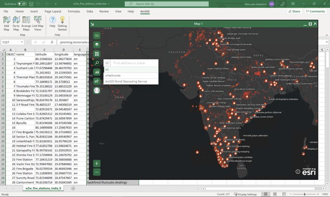
- You can display the locator on the search bar;
- You can search what3words address;
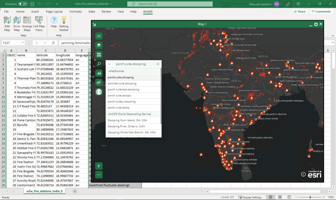
- You can use the autosuggestion functionality on the search bar to find the right what3words address;
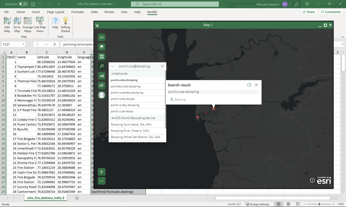
- You can convert a what3words address typed on the search bar to a point feature on the map (convert to coordinate);
- You can plot a list of what3words addresses from an Excel spreadsheet into the ArcGIS map by using what3words as geolocator.
Prepare your Excel spreadsheet that you will be adding to the ArcGIS map.
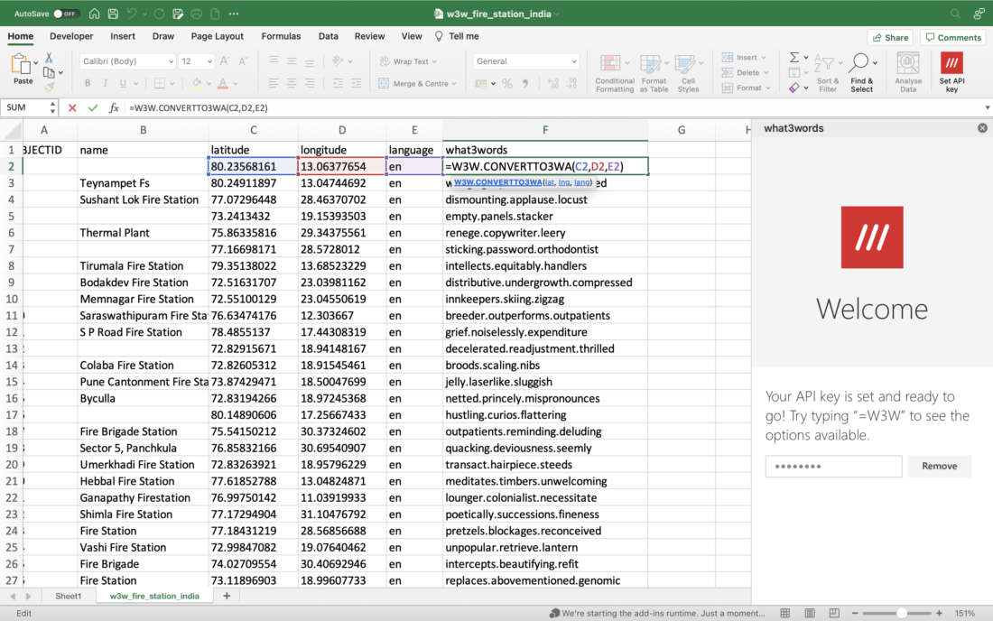
You could also use what3words Excel Add-in to convert a list of coordinates to what3words addresses, please follow the instructions here.
After installing and configuring ArcGIS for Office, an ArcGIS tab will appear on the Excel Ribbon, click on it to display the ArcGIS tools.
Note: If you don’t see the ArcGIS tab, download ArcGIS for Office. If you’ve already installed ArcGIS for Office, see What’s new in ArcGIS for Office or Frequently Asked Questions for a possible solution.
Before you can use the tools, you must first sign in to an ArcGIS organizational account (or an ArcGIS Enterprise organizational account).
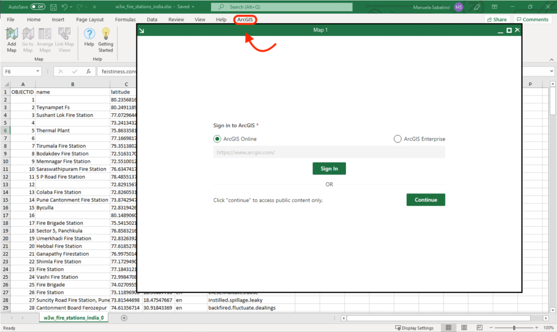
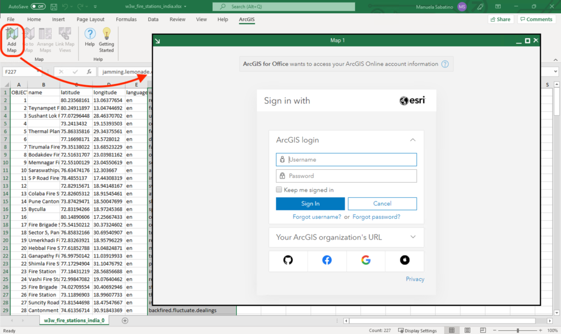
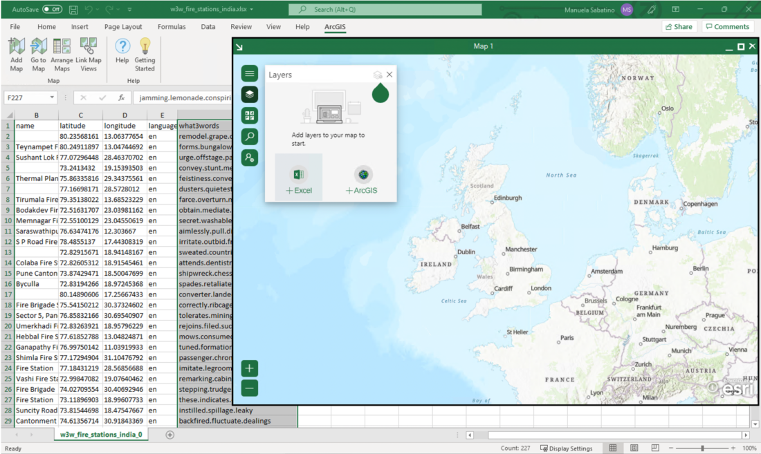
On the Excel ribbon, on the ArcGIS Maps tab, click Add Map. The Map 1 window appears. In the Map 1 window, click Sign In and sign in to your ArcGIS organizational account.
The Map 1 window is going to display a blank map and an empty layer list, as you haven’t added any layers yet. At the bottom of the layers panel, users can choose to add data t the map in 2 ways:
- Add from Excel
- Add from ArcGIS
You can choose to add the Excel spreadsheet data that they have previously prepared, as shown in this example. Click Add from Excel and a panel will appear. ArcGIS for Office provides two ways of adding data from Excel: from a table or a cell range. In our example, we will add the data from a range of cells in the spreadsheet. Checked the first row contains headers to preserve these as attribute field names, which will help you style the map later.
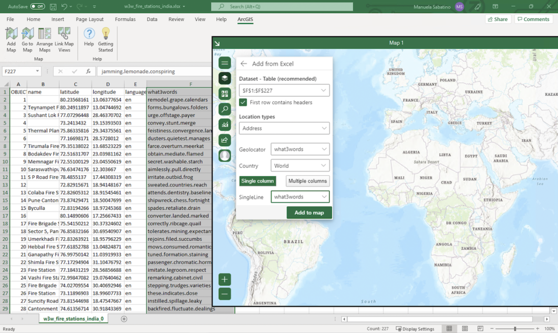
Next, you will specify the mapping options and confirm the location information for the what3words field. Since you are logged in to ArcGIS Online and you have shared the what3words locator across the ArcGIS Platform, you will be given the choice to use what3words as the geolocator, country as the world, and the what3words field as the location field, which is only a single column. Then click Add to Map.
Or you can add your layers from ArcGIS Online or your ArcGIS Enterprise.
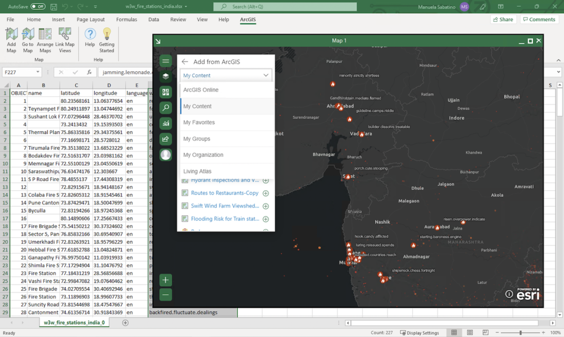
If you are connected to your ArcGIS Online, as shown in this example, and you choose a web map, it would look like this:
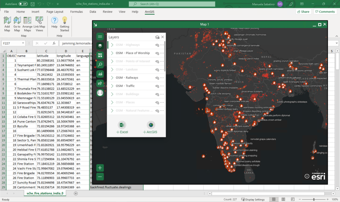
You can use their what3words locator on their search input bar.
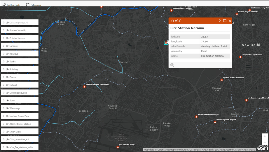
You can use the locator in the same way you will use it on the ArcGIS online, by typing a what3words address, a list of suggested what3word addresses will come up.
Click on the what3words address that you were searching for, and a point will appear on the map with a pop-up with the search result.
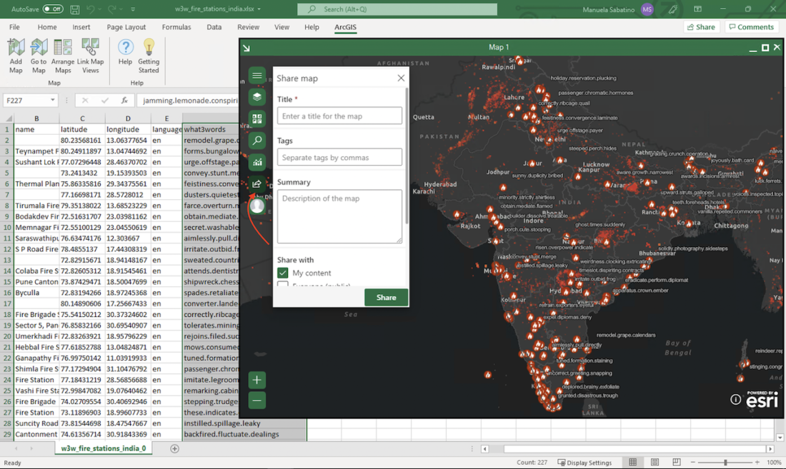
Now that you have a map with your data, you can share this map on ArcGIS Online to present your results.
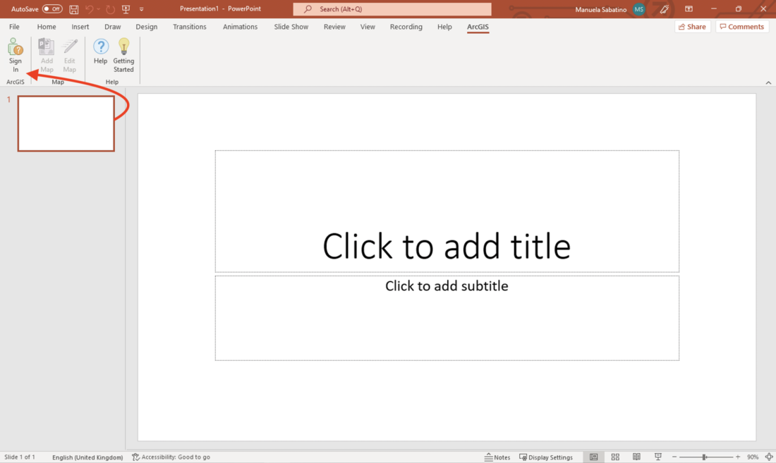
You could also add this dynamic map to your PowerPoint presentation. To add it, you need to make sure you are logged in.
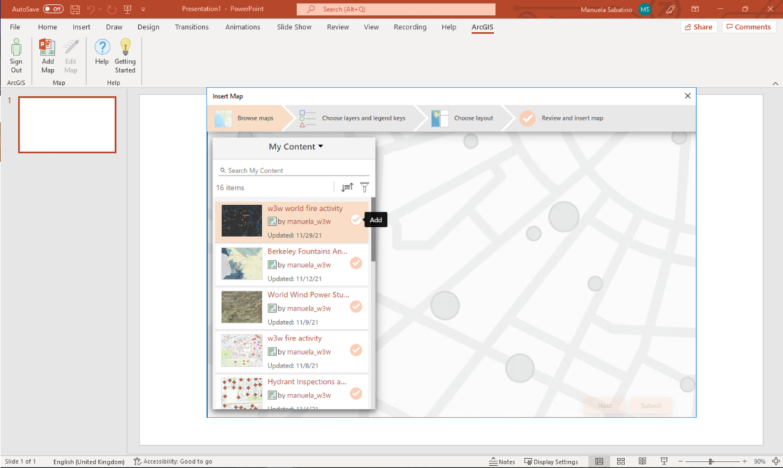
Browse maps: Then browse your maps, you can use the drop-down menu at the top of the panel to choose where to browse—for example, in My Content or in ArcGIS Living Atlas—and type keywords into the search box to narrow the results. Click the check mark next to a search result to select and add it. Once you have found and added a map, click Next.
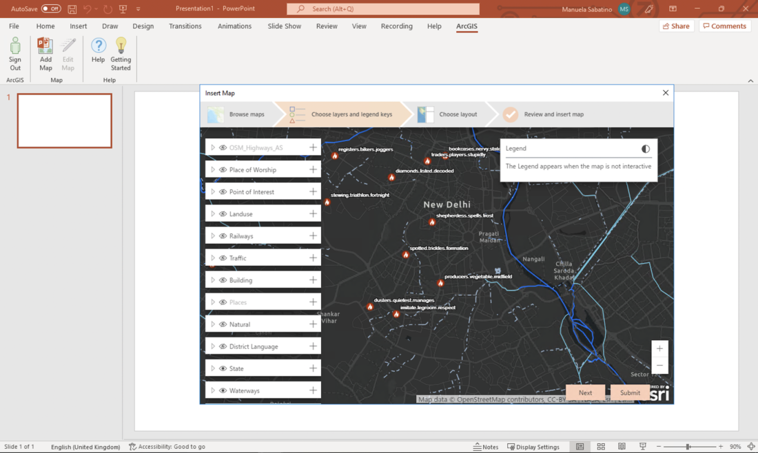
Choose layers and legend keys: Now, choose which layers and legend keys appear in your dynamic map.
You can use the Show/hide layer button to control whether a layer appears on the map. You can add the layer’s symbology as a legend key, by clicking the plus button next to the layer name. When you’re happy with your layers and legend, click Next.
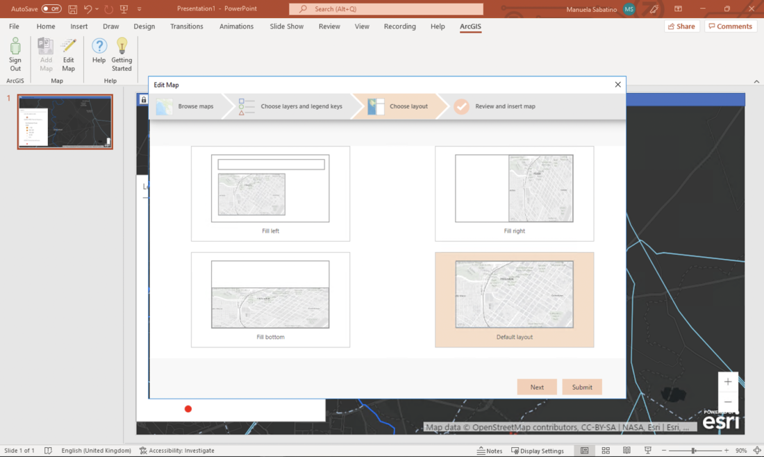
Choose layout: Decide how you want your map to appear on the slide. It can be inset, taking up only a portion of the slide, or it can fill the whole slide. After selecting your layout, click Next.
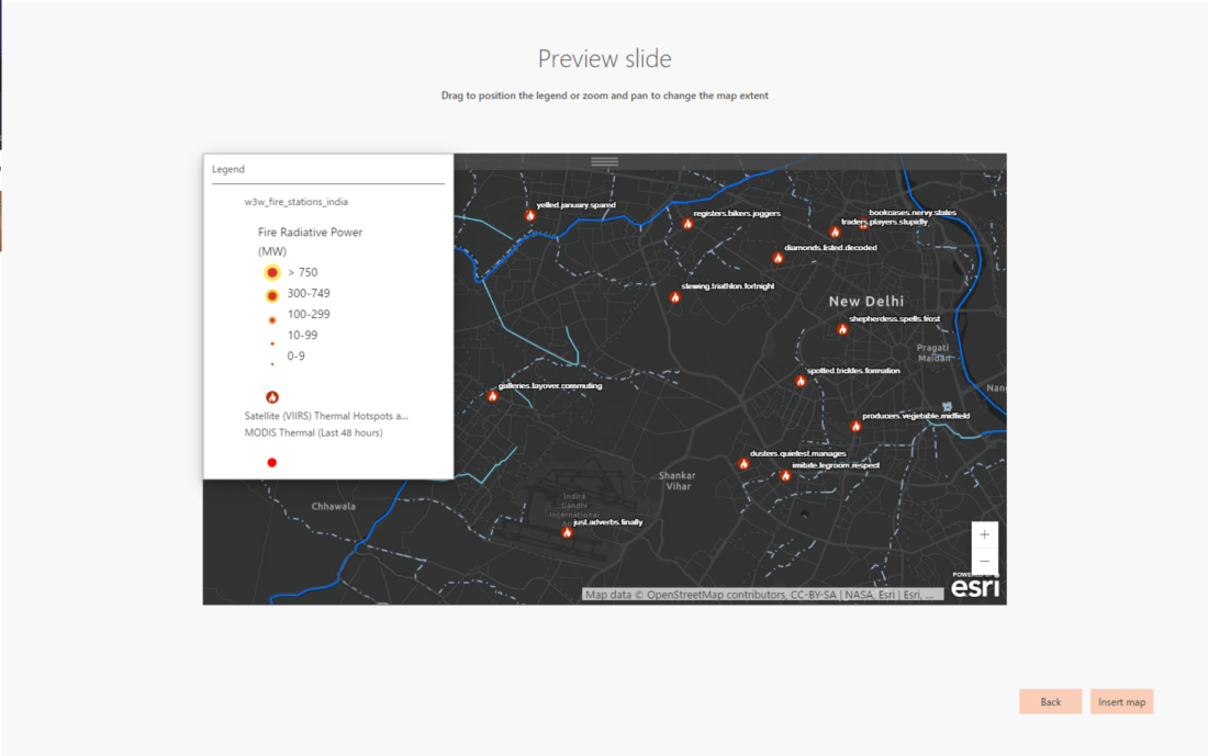
Review and insert map: This final step in the workflow is a preview of what your slide will look like. Adjust the placement of the legend and zoom the map to your preferred extent. Click Insert map to create your dynamic map slide.
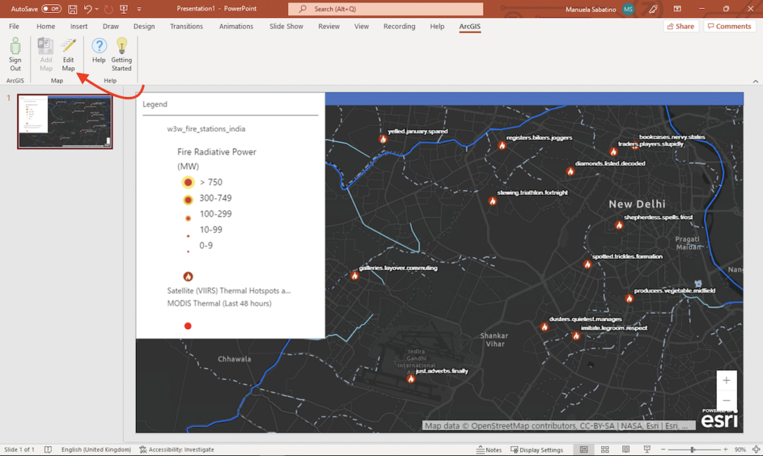
Now, your map has been embedded in your PowerPoint presentation. Press the Edit button on the ArcGIS ribbon to edit the map if you need to amend it.
When you enter Slide Show mode, the map appears as a static image in the layout that you selected earlier. Click the lock icon at the top of the map to transition to live mode and interact with the map.
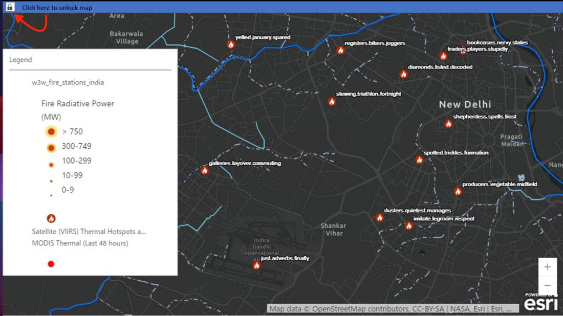
You can pan, zoom, view pop-ups, and even view the map in full-screen if you press the full-screen button at the top of the map next to the lock. To lock it again, you will need to click on the unlock button.