All tutorials
How to add the what3words Locator to ArcGIS for SharePoint
This guide describes how to use what3words ArcGIS Locator in the ArcGIS for Office application adding a geographic component to the data analysis capabilities of Microsoft Office. ArcGIS for Office is a free add-on that works with your existing ArcGIS subscription. You can transform your Excel data, graphs and charts into interactive maps to see data from a different perspective. Then, use Microsoft PowerPoint to share your map, embedding it in your PowerPoint presentations. By adding a dynamic map you take your slides to the next level.
- To use what3words ArcGIS locator in ArcGIS for Office application, you need to have an ArcGIS subscription to allow you to use the geocoding functionality. Please make sure you have installed the what3words ArcGIS locator on your ArcGIS Online account and share it across your organization, follow the instructions here;
- To Install the ArcGIS for Office on a Microsoft Office site, please follow these instructions;
- When the installation is completed, please make sure to configure ArcGIS for Office.
- You can display the locator on the search bar;
- You can search what3words address;
- You can use the autosuggestion functionality on the search bar to find the right what3words address;
- You can convert a what3words address typed on the search bar to a point feature on the map (convert to coordinate);
- You can geosearch the what3words field from a layer;
- You can use the what3words field to geotag a SharePoint document.
Choose a page on which you want to insert an ArcGIS for the SharePoint web part.
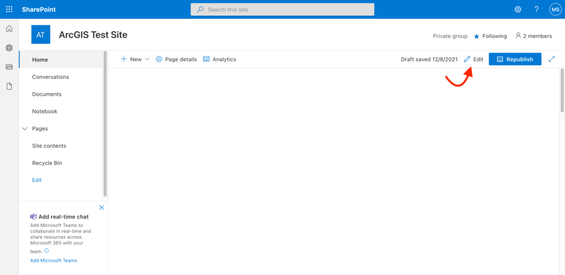
Click on the Edit button on the top right side of the page.
Click the location on the page where you want to insert the ArcGIS for the SharePoint web part.
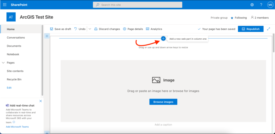
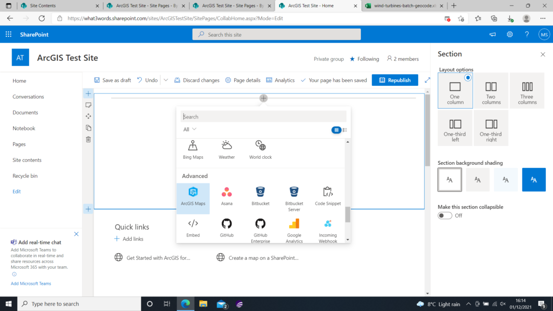
Search for the ArcGIS Maps integration and select it.
The ArcGIS for SharePoint web part appears on the page, prompting you to sign in to ArcGIS or continue in the standard experience.
Note: If an error message pops up saying that the app is not configured, your SharePoint administrator needs to set the credentials to enable the app for use.
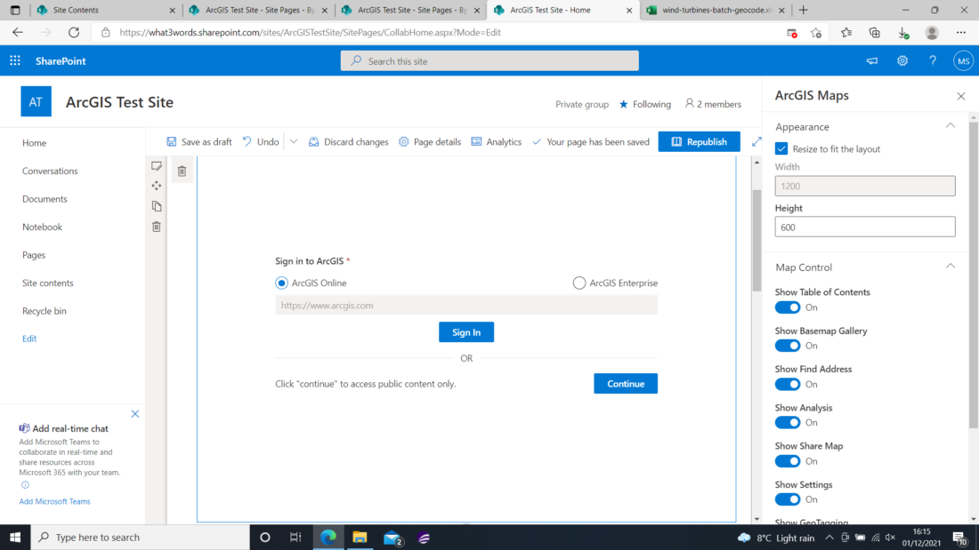
Sign in to an ArcGIS Online or ArcGIS Enterprise account to have the privileges to create, analyse, and share content. The map loads using the default basemap and map settings.
To save the SharePoint page, click on Save as draft.
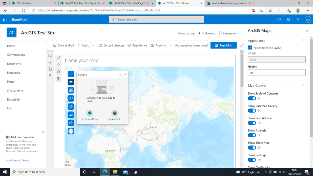
With ArcGIS for SharePoint, you can add spatially enabled lists containing addresses or place names, or lists containing coordinate data, to a map. Once added, they become layers in the map.
Note: Currently, the what3words address field is not recognised as a spatial field.
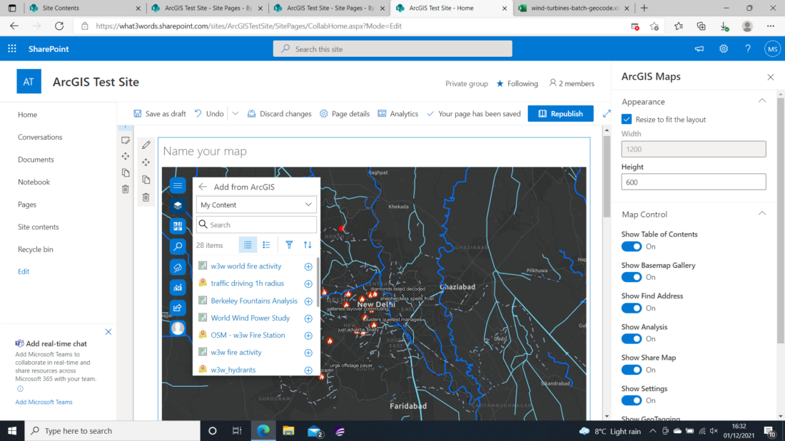
Turn the Edit mode on the site. Then, from the map tools, select the Layers icon. A panel will appear with 2 choices: Add from SharePoint(+SharePoint) or add from ArcGIS(+ArcGIS). Pick +SharePoint to display the available lists in the current SharePoint site. Lists that are not spatially enabled appear inactive at the bottom and cannot be added.
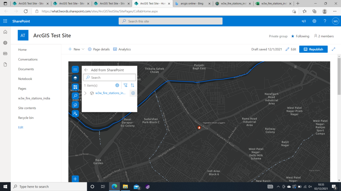
Once you have the list you want to add, click the Add button next to the list title (+). A layer containing the data is added to the map, and the map view zooms to display the full extent of the layer. The layer is listed in the layer list.
Click the Back button when you have finished adding layers from SharePoint to return to the layer list.
Turn the Edit mode on the site. Then, from the map tools, select the Layers icon. A panel will appear with the 2 choices above-mentioned, this time pick Add from ArcGIS(+ArcGIS). Search for a layer or a web map to add to the map from the drop-down menu, or type one or more keywords in the Search text box and press Enter. Once you are happy with the service you want to use, click its Add button (+), next to their name. A layer or web map containing the data is added to the map, and the map view zooms to display the full extent of the layer. The layer is listed in the layer list.
Click the Back button when you have finished adding layers from ArcGIS Online to return to the layer list.
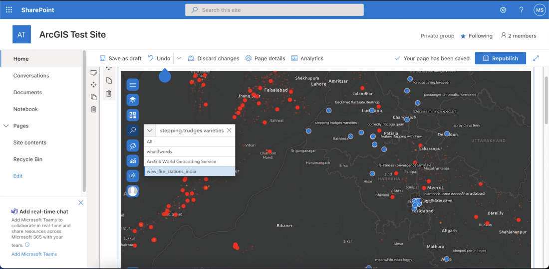
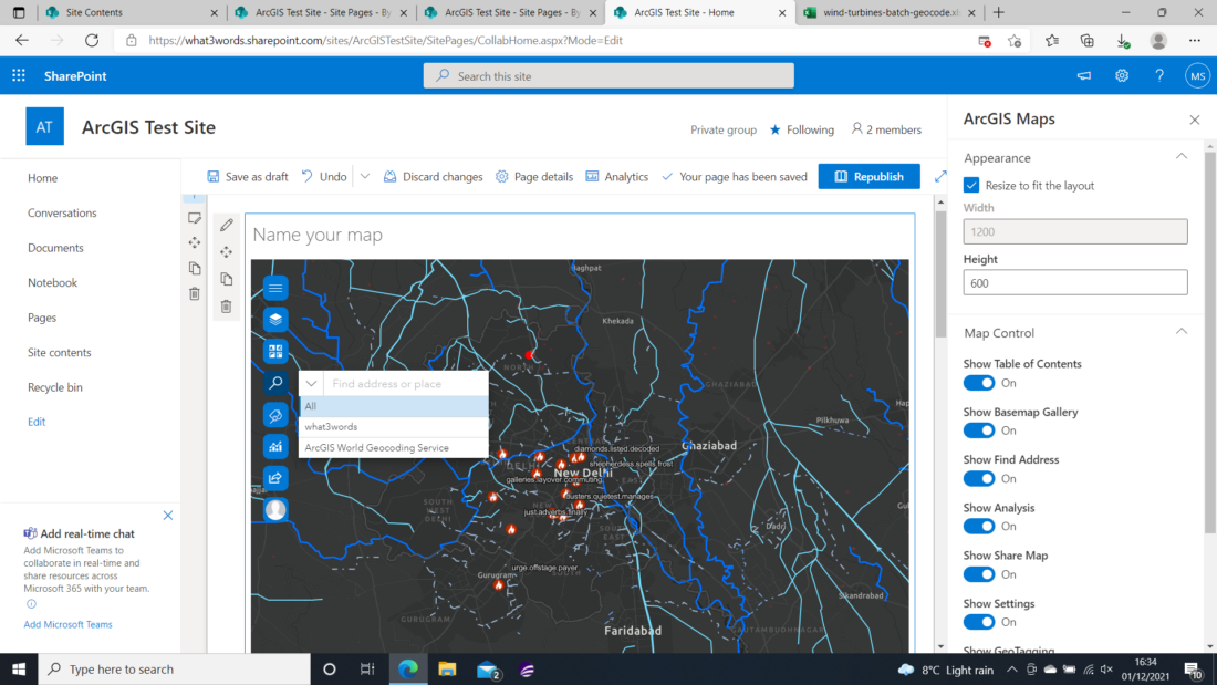
Go to the search icon on the left-hand side of the map. The what3words locator will appear along with the default ArcGIS World Geocoding Service. Follow these instructions if you haven’t shared the what3words locator across the ArcGIS Platform.
You can type any what3words locator on the Search input bar. An Autosuggested list of what3words addresses will appear after start typing the first letter of the third word.
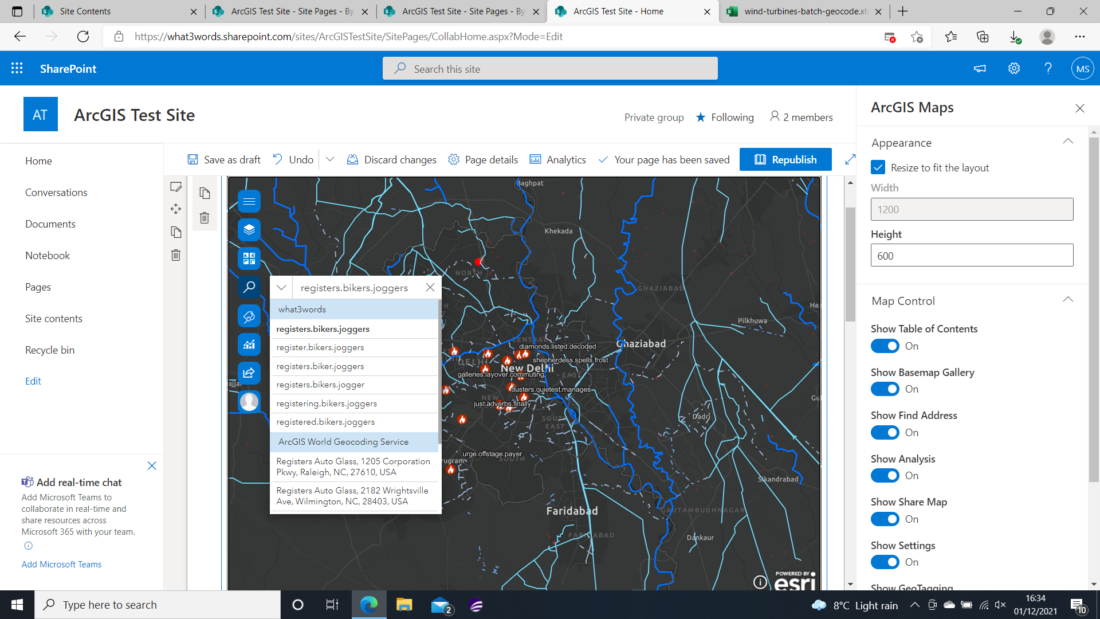
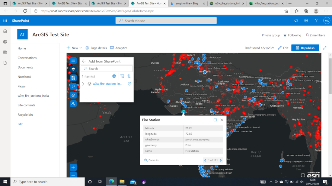
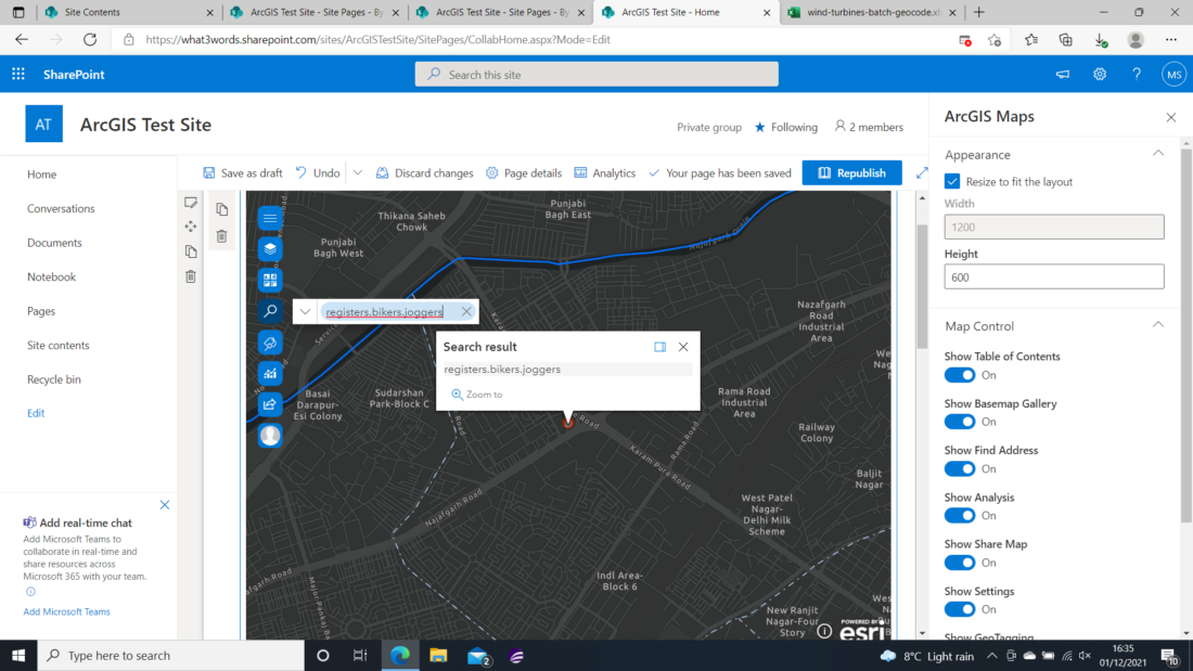
Click on the what3words address that you were searching for, and a point will appear on the map with a pop-up with the search result.
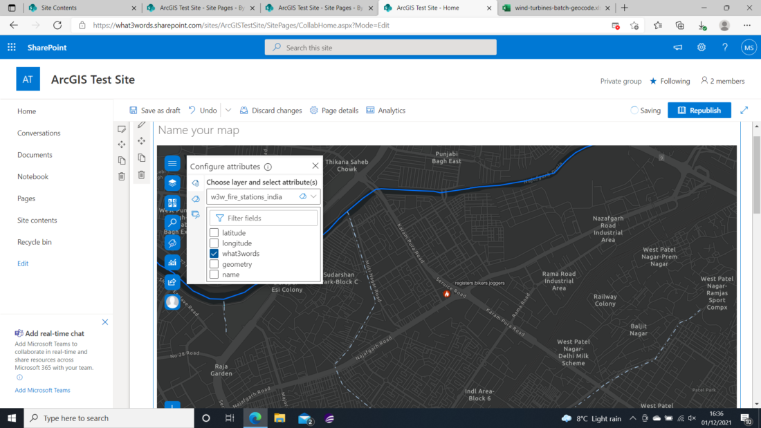
ArcGIS for SharePoint offers a new feature that enables users to geotag SharePoint documents by using attributes from referenced layers. You can perform a geosearch to quickly find documents not only in your SharePoint site collection but also across your organisation based on a location on the map or attributes assigned to the documents as geotags.
By adding a SharePoint document with a set of coordinates and a related what3words field, you could select the what3words attributes as shown in this example.
Then you could make sure you can geosearch on the what3words attribute by checking the Show search results from the SharePoint document with the what3words attribute.
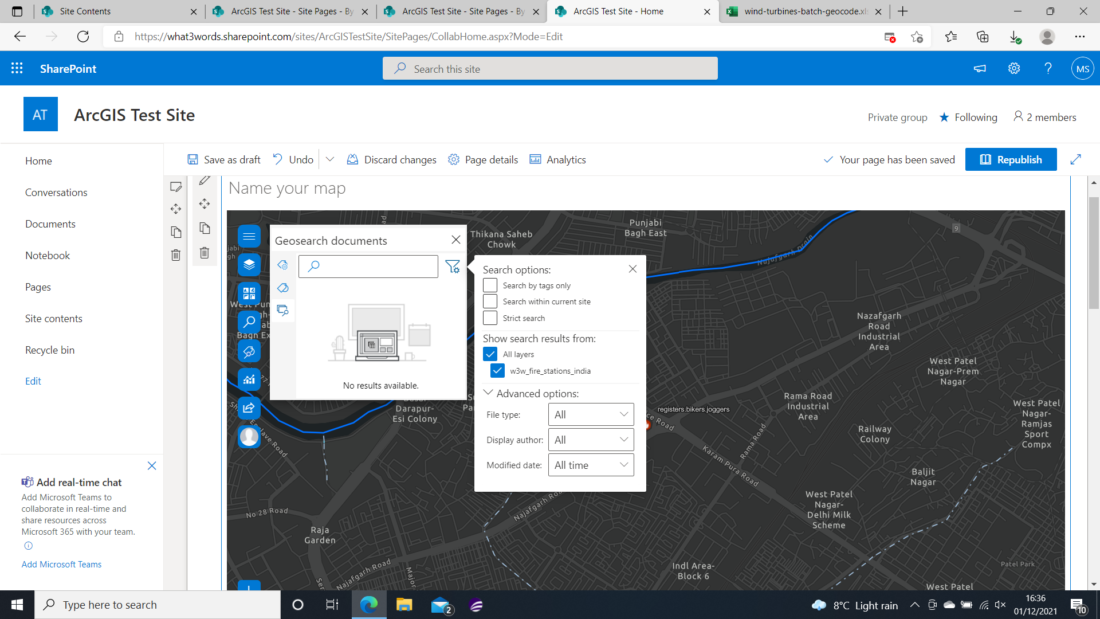
Now you will be able to display this SharePoint document on the search input box. If you select this document, you will be able to georesearch specifically your what3words attributes that are on the document.